|
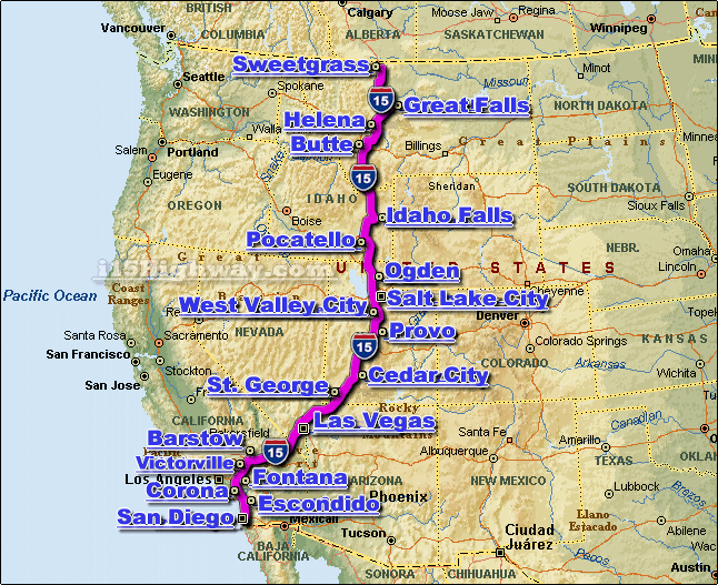
The I-15 Interstate 15 Highway is
a major
automotive transportation
corridor and interstate highway that travels generally in a north-south
direction across the western United States.The
i-15 corridor connects a
number of larger cities located along it's route, including;
Butte, MT,
Escondido, CA,
Las Vegas, NV,
Provo, UT,
Salt Lake City, UT,
and
San Diego, CA, just to name a
few.
The i-15 travels through 6 different states, including;
Arizona, California,
Idaho, Montana,
Nevada, and Utah.
From the south, the i-15 travels north from the metro
San Diego CA area all the way
north to the US/Canada border at
Sweetgrass MT.
The entire length of the I-15 is approx. 1,433 miles long, and requires a
continuous driving time of approx. 23 hrs. and 53 minutes to complete
when driving an average speed of 60 miles-per-hour.
We currently provide real-time
traffic maps
for over a dozen cities located along the i-15 corridor, as well as,
i-15 corridor news, and
i-15 corridor weather.
|